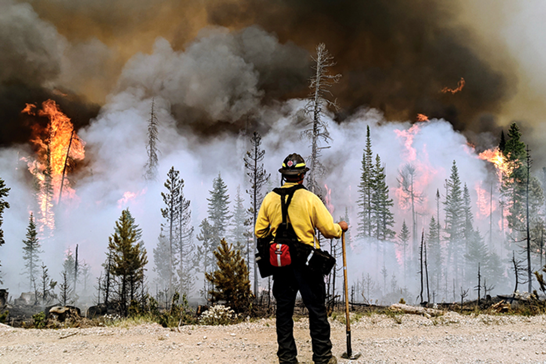
All summer, as 90-degree days continued to bake Northern Colorado like a piece of cornbread, without the afternoon thunderstorms that usually came with them, there were signs that something like the East Troublesome Fire could happen.
The Cameron Peak Fire in the Poudre Canyon was burning its way into the record books. The Mullen Fire was so big Wyoming and Colorado had to share it. Pine Gulch, near Grand Junction, had become the third largest fire in the state at 137,000 acres since it began July 31.
The air in Fort Collins, Greeley and Loveland smelled like a campfire, making something as simple as a run outside a dangerous exercise. The Grand Lake Fire Protection District had battled a half-dozen decent wildfires and eight small ones. The year of 2020 was already, literally, a hell of a summer, even if you didn’t include the coronavirus or racial tension or the most contentious election in history.
Still, a month after Oct. 14, when East Troublesome released its first curl of smoke, Dan Mayer talks about the fire with awe.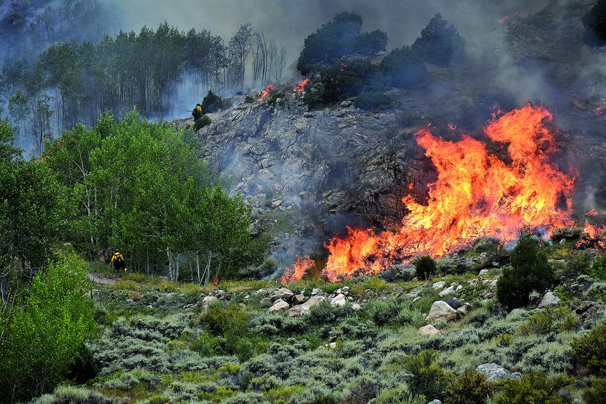
He knew when he first spotted the smoke that it would be bad. He’d seen the signs, too. The ground, he knew, was more like a plucked chicken waiting to be fried, desperately thirsty after a hot summer without the usual monsoon season to cool it, and heading into a fall that so far felt a lot like, well, summer. He also knew it started in an area that was nearly impossible to reach. They would have to hope for the best.
A week later, they got the worst, at a level that Mayer, without a hint of hyperbole, says he didn’t think was possible.
All Oct. 21 into late afternoon Oct. 22, in fact, Mayer found himself continually flabbergasted, as the fire, pushed hard and fast by fierce winds, exploded east across Grand County, into Rocky Mountain National Park and toward the Columbine Lakes development, the most concentrated subdivision in the county. That day, the fire swallowed a ridiculous 87,000 acres. You could see the glow from Greeley.
By the evening of Oct. 21, the blaze had terrified him more than he’d ever been scared in 34 years of law enforcement, and it shook him that hard twice, especially when he tried to get to an elderly couple who refused to leave their home and he just slipped away as sparks surrounded his truck. The couple perished in the fire.
Troublesome, which seemed powered by a dragon, took the winds that fed it and amplified them into gusts, Mayer believes, stronger than those carried by the Windsor tornado. The firestorm uprooted trees that could crush mansions. Mayer, in shock, had essentially written off Columbine Lakes and its 500 homes.
Still, before the fire, the district had identified Columbine Lakes as one of the most dangerous wildland fire communities in Colorado, as it was bordered by the national forest on one end and the national park on the other. Residents of the subdivision took it seriously, working through Firewise guidelines set by the National Fire Protection Association. They created so-called defensible space around their homes, cutting down trees, removing brush and essentially making it difficult for any fire, should it come, to find enough fuel to burn its way to their doorsteps.
It was a hard sacrifice in addition to the hard work. “Trying to get people to part with the beauty of their property is tough,” Mayer says. “But they did it.”
The fire, when it’s that big, seems like one monster, but as firefighters got into the subdivision, they found many so-called spot fires, tiny spawns of the blaze searching for somewhere to go. As they worked for hours that night, squelching spot fire after spot fire, Mayer’s attitude changed. Some homes looked as if people had built a half-dozen campfires around them, but they weren’t spreading. Mayer, for the first time since the fire blew up, felt useful again.
“There was a lot of adrenaline and excitement,” Mayer says. “We began to feel, ‘Hey, what we are doing is working.’ The more you put out, the more excited you got. We are winning some of these battles.”
The fire, as fierce as it was, did destroy homes, as 361 in Grand County were lost among the 550 structures that burned. More than 70 percent were vacation homes, but that meant more than 50 people lost their primary residence. Even those who took and preached preventative measures lost their homes. Schelly Olson, a member of the Grand Fire protection district and the chairperson of the Grand County Wildland Fire Committee, lost her home.
But that night proved that mitigation works, even staring down the flames of a beast, as it could have been so much worse. That subdivision lost less than 10 percent of its homes.
“You don’t want to get excited about a fire,” Mayer says, “but damn, that was actually pretty good.”
An annual occurrence?
When you think about it, of course 2020 would bring us the worst fire season we’ve ever seen. But experts saw this coming for years, even before all hell broke loose. The state’s top 10 fires have all occurred since 2002, with the top three all happening this year, including two in Northern Colorado.
Climate change is here, and it’s drying out and heating up our overgrown forests already dead or dying from the pine beetle, to the point where huge wildfires may happen every year.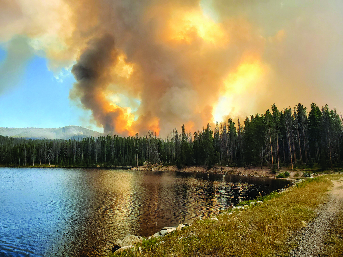
“There’s nothing we can do to turn around climate change quickly,” says Scott Franklin, a professor of Biology at the University of Northern Colorado who studies disturbances. “The next decade, at least, we are in a scary situation.”
Some of those fires, Franklin acknowledges, were just bad luck, as high winds drove them to an unprecedented fury. But when the conditions are already ripe for large fires, it doesn’t take much to spark them, he says. The high country and foothills, where much of the thick forest exists in Northern Colorado, didn’t experience their usual slate of summer showers and afternoon thunderstorms, or any kind of a monsoon season at all this year. Drier, hotter weather are hallmarks of climate change, the kind that’s gripped California in an historically bad drought for years.
“We haven’t had good precipitation since August,” Franklin said in late October, just before a soaking snowstorm assisted firefighters with both Cameron Peak and East Troublesome.
Franklin’s solutions are the same solutions that the U.S. Forest Service has worked on for years, mainly thinning the forests, and encouraging homeowners in the hills to do the same. Franklin also suggested running prescribed burns before homeowners start building in the mountains.
But he also knows it’s not as easy as it sounds to thin forests. “I think it’s a combination of policy and money,” Franklin says. “They want places to be more natural, but the problem is they are already unnatural with the suppression of fire. Plus, thinning of forests is something that is taking place along the Front Range, but you can’t do that over millions of acres of forest.”
Fighting fire before the fires
Indeed, the U.S. Forest Service has already ramped up thinning efforts, including the use of prescribed fire, says Reagan Cloudman, the spokeswoman for the Roosevelt and Arapahoe forests and the Pawnee Grassland.
The forest service is a part of the Northern Front Range Fireshed Collaborative, a group of land and fire managers, water providers and researchers who want to do more. The forest service also received a Joint Chiefs Award to help with these efforts. And lately, the forest service shifted its focus to look at using prescribed fire across vast swaths of landscape on both public and private land, as more owners have gotten more comfortable with embracing prescribed fire on their property.
“When we get them engaged,”Cloudman says, “it’s much easier to treat larger areas, and it can even provide necessary access to do even more.”
However, some areas are hard to reach with heavy equipment. And fire is, well, a nasty, unpredictable beast. “It’s a great tool, but the stars have to align,” Cloudman says. “You have to have good weather, good staff and good equipment.”
Prescribed fire, in other words, may not have been the best tool by August, in a forest that resembled a pile of fireworks. But there were cases this year in the Cameron Peak fire where past prescribed burns helped slow the flames.
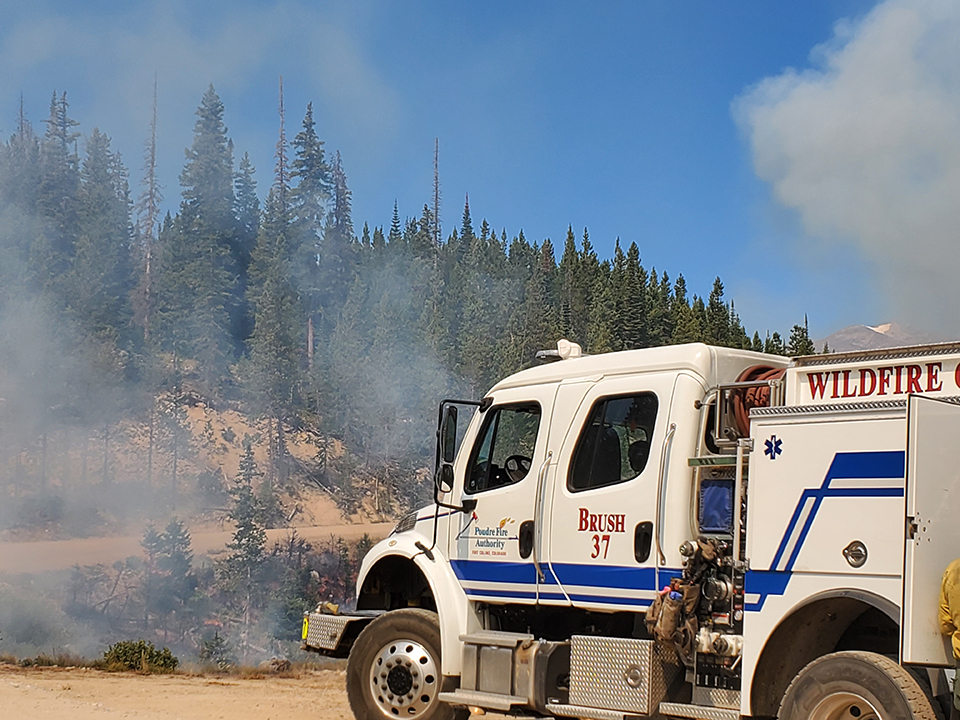 One prescribed burn, near the Roaring Creek Trailhead, gave the fire thin grasses as fuel instead of thick tinder, starving out the flames. Another series of burns near Pingree Park kept the fire north of Kelly Flats road. Even if the fire were to still spread, it wouldn’t have the intensity of, say, East Troublesome, so firefighters can win some battles, as they did that night in the Grand County subdivision.
Rocky Mountain National Park officials recognized the danger more than 20 years ago, even before 2002 changed the way people think about wildfires. The park thinned growth in forests since that time, and more than five years ago put together a comprehensive fuels program with the goal of creating a “catcher’s mitt” around Estes Park, Allenspark and Lily Lake, said Fire Management Officer Mike Lewelling in a news release.
The projects include more aggressive thinning and prescribed fire. Those treatments protected housing and the visitor center on the west end of the park and reduced the intensity of fire on the east side.
So, if everyone is sold onthe idea, why did Cameron Peak become the largest fire in Colorado’s history (at more than 200,000 acres burned)? Well, the Canyon Lakes Ranger District alone is 650,000 acres of forest, and not all of that is accessible. The forest service is searching for ways to burn, such as using snow as containment areas, but snow also makes it tougher to reach certain areas.
“It just takes time,” Cloudmansays. “We are trying to find ways to burn more days and give us more opportunities.”
All that still frustrates peoplesuch as Kale Casey, the public information officer for Cameron Peak. He acknowledges drought conditions were so bad, they came up with a new level, “exceptional,” which probably meant the fire would have burned hot and heavy even with more mitigation. East Troublesome, for instance, burned through 170,000 acres from Oct. 20 to 23, a number that stunned fire officials.
“But there’s a lot more forest out there,” Casey says, “with every single piece in an exceptional drought condition, and there are still homeowners who haven’t done a darn thing. People don’t want to cut their favorite trees. That doesn’t work anymore.”
Casey compared the forests in this area to Vail and all those beetle-killed trees you see along Interstate 70, knowing that there are hundreds of thousands of acres in a similar condition remains scary. “At what point is all that a loaded gun?” he asked.
Fighting fire with…fire?
Franklin packaged his dark assessment of what the future holds for forest fire in Northern Colorado with a little dark humor. “I mean, if everything burns,” Franklin says, “the fires won’t be that bad in the future.”
Franklin was joking, but if there is any bright side to this year’s burn, it’s that the scars will protect the forest from more huge fires that are sure to bloom in the coming years of continued climate change. The High Park fire in the mountains west of Fort Collins in 2012 and other fires helped.
“There is always the potential for more fire,” says Larimer County Sheriff Justin Smith. “However, the 200,000 acres of burn scar do create some protection. Many previous burn scars provided protection from the advancement of Cameron Peak and East Troublesome fires.”
The heavy price for that future protection included more than 220 homes lost to Cameron Peak (although just 30 or so were primary residences) and more than 300 homes lost to East Troublesome, although the majority were vacation homes.
Both fires caused damage to watersheds that Greeley believes will take up to $50 million, most from federal money, to mitigate for their holdings alone. Fort Collins expects to spend up to $4 million of city money on recovery.
Since the arrival of the pine beetletwo decades ago, Smith says, the concern for wildfires has been high, and there was special concern that a fire might start near the Divide in the beetle kill, which is what happened on Aug. 13 when Cameron Peak sparked. The Rawah and Comanche wilderness area is not just thick but roadless. Smith and other officials looked at that fire and the eventual combined threats of Mullen, East Troublesome and others.
“We had potential for nearly every inch of our forests across Larimer County [to burn],” Smith says, “and we developed evacuation plans for all those areas. It was a scenario we had never previously contemplated, but it’s one we were facing.”
It’s hard to know if Colorado will face another fire season like this year as soon as 2021. But there’s also no doubt it could happen again, Mayer says. “There’s plenty of fuel up here.”
Next year, Mayer expects more money allocated to wildland fires and more staff, and you probably won’t see fire districts willing to share personnel, as Grand County did this year to help fight other fires, a decision that didn’t please Mayer: “I guarantee you that won’t happen again,” he says.
Mayer also expects to see more owners mitigating their property and perhaps more work on federal land as well next spring. Finally, he expects everyone to be on edge, especially if the dry, hot weather continues, as it is forecasted throughout the winter.
“There will be a high degree of paranoia next year,” Mayer says. “We had people calling us this year about smoldering snow, with 8 inches over it. Next summer, one puff of smoke will get a ton of calls, and for years to come, until everyone lets their guard down again.”
What did the fires do to my favorite recreation areas?
The Poudre Canyon, a popular area for hiking, camping and rafting, took a significant hit from the Cameron Peak Fire, while the East Troublesome Fire scorched part of the west end of Rocky Mountain National Park.
In the Poudre Canyon, Jack Gulch Campground was essentially destroyed, as four of the six vault toilets burned and a lot of work will be required before it can open again, says Reagan Cloudman, spokeswoman for the U.S. Forest Service’s Arapaho and Roosevelt National forests and the Pawnee National Grassland.
Some roads were also damaged, and many trails are littered with hazard trees. Some of the canyon’s prettiest areas were damaged as well, including Chambers Lake and Pingree Park road, where a lot of dispersed camping takes place, and the Roaring Creek Trail. “Visually…well, it will just look different,” Cloudman says. “That will take a long time to recover.”
The areas around the 200,000-acre fire will be closed as they repair the landscape and remove trees, including those cut down to build a fire line.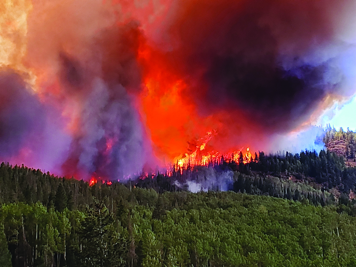
The damage also makes the area more dangerous, as mudslides, debris in the river and rockfall all are more common after a big fire. Cameron Pass is closed, and it’s unknown when that will open to the popular snowshoeing and cross-country skiing that take place there.
The two fires burned 30,000 acres in the boundary of Rocky Mountain National Park and destroyed park structures in the west end of the park the day East Troublesome burned nearly 90,000 acres in a day.
Some structures include the park’s Trails and Tack Barn and all its contents, the Grand Lake entrance station office (sparing the entrance kiosks themselves), the historic Onahu Lodge and Green Mountain cabins and the Harbison Meadows vault toilet facility. The main park housing area, the Kawuneeche Visitor Center, the Trail River Ranch main building and Buckaroo Barn were all spared.
On the east side, the Fern Lake Backcountry Patrol Cabin, built in 1925, was lost.
The park will assess when it can open areas affected by the burn.
What did the fires do to the water supply?
Both fires caused serious damage to the watersheds that serve Greeley, Fort Collins, Loveland and the surrounding communities.
Greeley declared a local disaster emergency in mid-November after learning mitigation could cost up to $50 million.
“We know there will be severe and significant impacts that will need to be addressed for probably a decade to come,” said Sean Chambers, Water and Sewer director, at a city council meeting in November.
Cameron Peak Fire damaged many water basins, including the Poudre River, Big Thompson, Laramie River, Upper Colorado River (Windy Gap and Colorado Big Thompson) and will affect watershed health, operations, storage capacity and, perhaps most of all, water quality. Northern Lakes Water and Three Lakes also reported damage from East Troublesome. Estimates suggest there will be up to 25 times more sediment in the water, which makes it much more expensive to treat.
“This is really unprecedented, never-before-seen damage to City of Greeley watersheds,” Chambers says.
The way fire changes a landscape also changes how water behaves on it. The intense heat burns vegetation that provides social stabilization on hillsides and riverbanks, says Shayle Nelson Sabo, emergency management coordinator with the Larimer County Office of Emergency Management. That creates a waxy layer on top of the soil that allows it to run off more easily, creating mudslides and making it easier for sediment and debris to reach rivers and reservoirs.
What was the damage?
Cameron Peak burned more than 208,000 acres and was fully contained in December, making it the largest in Colorado’s history. Of the 461 structures destroyed by the fire, 224 were homes, and 42 of those were primary residences. The fire caused no deaths or injuries.
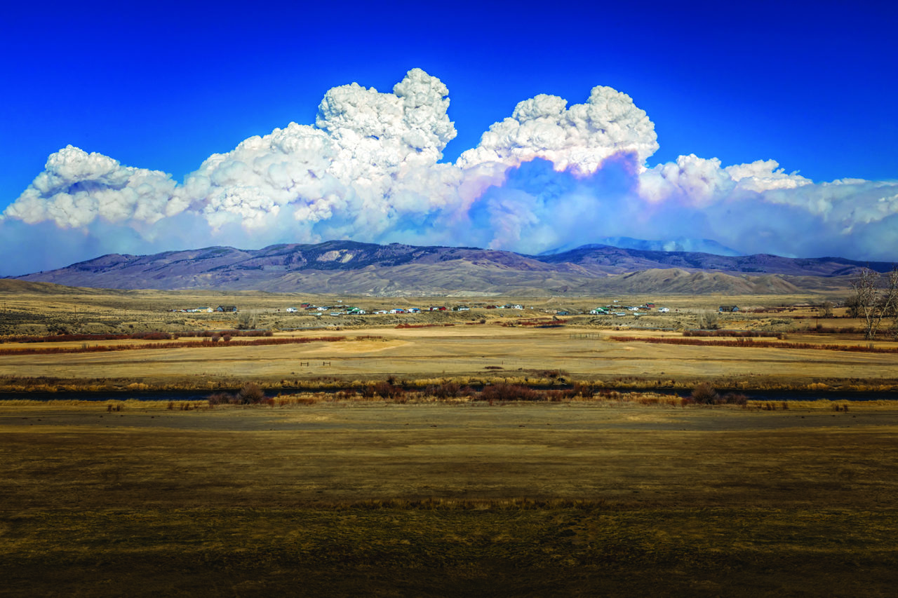
The East Troublesome Fire burned 193,000 acres as of Nov. 20 and was contained in early December. It is the second-largest fire in state history, and the 87,000 consumed in one day has to be some sort of record.
It damaged 589 structures; 366 were homes. The fire killed an elderly couple, Lyle and Marilyn Hileman, when they refused to leave their home just outside of Grand Lake.
What caused them?
Both fires were under investigation as of late November, although both are believed to be caused by humans.
Dan England is a freelance writer who lives in Greeley. To comment on this article, emailletters@nocostyle.com.


